Leave Your Message
0%

Picking out the right rescue drone really starts with understanding the mission, not just focusing on the camera. Search teams might be working over dense forests, along coastlines, up in the mountains, or in busy urban areas—all of these locations have their own unique requirements. For example, a small, lightweight drone can be launched quickly from a vehicle and is perfect for rapid deployment, while a larger one might carry thermal cameras, loudspeakers, or even emergency supplies. Of course, bigger often means heavier, which can mean more training and maintenance. It’s not always a straightforward choice.

Patrick Meier, who’s a big name in humanitarian tech and author of Digital Humanitarians, gives a pretty good warning: “Drones are not a silver bullet.” That’s his way of keeping everyone grounded—drones are awesome but aren’t a magic fix. They’re meant to support trained responders, not replace human judgment, ground teams, medical care, or solid communication lines. The term Sar Drone=Search And Rescue Drone sounds pretty simple, but, trust me, choosing the right equipment isn’t.

This guide walks through a bunch of key factors—flight time, thermal sensors, obstacle avoidance, how well they work at night, portability, and keeping data secure. We’ll also look at support software, spare batteries, what kind of training pilots need, and how reliable the manufacturer is—think DJI Enterprise, Skydio, Autel Robotics, and similar brands. Let’s be real—rescue missions are rarely perfect. Winds can pick up unexpectedly. Batteries get old. Signals can get weaker behind walls or over ridges. No matter what the specs say, there are always problems you can’t predict. So, it’s super important for anyone thinking about a drone to actually test it out in real-world scenarios before pulling out the wallet. Take note of how long it takes to launch, how clear the images are, how easy the controller is to use, and how well it recovers after a flight. Sure, cheaper drones might look tempting, but hidden costs for training and maintenance can bump up the real expenses. The best rescue drone isn’t necessarily the latest or most high-tech model. Instead, it’s the one that’s safest, most reliable, and fits the specific terrain and response needs of the team."
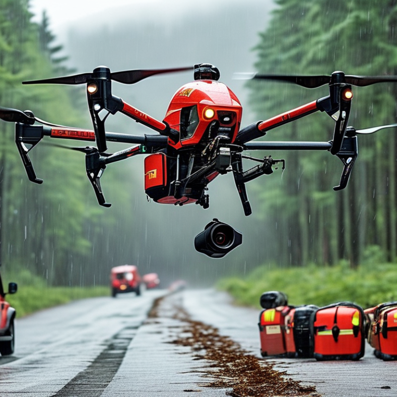
How to Choose the Best Rescue Drone for Your Needs?

Define the Rescue Mission and Operating Environment

Choosing the best Rescue Drone starts with defining the mission, not comparing specifications. A coastal search differs greatly from an urban collapse or mountain evacuation. Identify the person you must locate, the search area, and the response time. A missing hiker may require thermal imaging at dusk. A flood response may need a loudspeaker, spotlight, or small medical payload.

Then study the operating environment in detail. Measure typical wind, rain, temperature, visibility, and signal interference. Tall buildings can block satellite positioning. Narrow valleys can weaken communication. Salt spray can damage poorly protected equipment. At a real search site, operators may face wet gloves, poor lighting, and changing weather. Controls must remain clear under pressure.

Battery endurance should include return time and a safe reserve. Do not plan around the ideal flight duration. I have seen field plans become unrealistic after a strong headwind appeared. That mistake is easy to repeat. Check launch and landing space, obstacle clearance, night-operation requirements, and local aviation rules. Reliable teams also test the drone, sensors, batteries, and data link before deployment. A short practice flight near the actual terrain can reveal more than a brochure. Choose equipment that matches the mission’s honest limits, even when those limits are inconvenient.

Compare Drone Types and Essential Rescue Capabilities

Choosing a Fire Rescue Drone starts with the scene, not the camera. In training exercises, a compact multirotor can hover beside a burning warehouse and inspect windows quickly. Its thermal sensor may reveal a person behind smoke, while an optical camera confirms clothing, movement, and structural details. Multirotors suit confined areas, but their batteries often limit long searches. That weakness matters.

For wide terrain, a fixed-wing or vertical-takeoff drone covers more ground and remains airborne longer. It needs open launch space and careful route planning. A tethered drone offers continuous power and steady overwatch near an incident command post. However, its cable can restrict movement and create a snag risk. Choose based on terrain, wind, smoke, and distance, not advertised flight time.

Essential rescue capabilities include thermal imaging, low-light video, strong zoom, obstacle avoidance, and reliable live transmission. Look for weather resistance, replaceable batteries, accurate positioning, and simple controls under stress. A loudspeaker or spotlight can support communication, but payloads reduce endurance. Test the drone with gloves, wet hands, and poor visibility. Teams should practice lost-signal procedures and record flight logs for later review. I would not trust a single sensor; reflections, hot roofs, and smoke can mislead operators. A second viewpoint or trained observer can expose those mistakes.

How to Choose the Best Rescue Drone for Your Needs?

This comparison uses a practical 1–5 capability scale based on common operational characteristics of rescue drone types. Higher scores indicate stronger suitability for the listed rescue task.

Multirotor drones are generally effective for hovering, close inspection, and confined-area searches. Fixed-wing drones typically provide longer coverage over large areas, while VTOL hybrid drones combine vertical takeoff with efficient forward flight. Tethered drones are well suited to persistent observation and continuous power near an incident site.

Evaluate Flight Performance, Range, and Weather Resistance

Choosing the best Maritime Rescue Drone starts with flight performance, not camera resolution. A rescue aircraft must launch steadily, hover beside a moving vessel, and return safely in changing wind. During field testing, watch how quickly it responds to control inputs. Slow corrections can waste critical minutes. Test it near spray, but avoid unsafe conditions. Small details matter.

Range figures often describe ideal, empty-air conditions. Salt air, strong wind, payload weight, and repeated hovering can reduce practical distance. Ask whether the controller shows live battery status and signal strength. Keep a realistic reserve for the return flight. Do not trust the final percentage blindly. I once overestimated battery endurance during a windy shoreline test, and the margin disappeared faster than expected.

Weather resistance deserves careful inspection. Look for clear protection ratings, sealed battery compartments, corrosion-resistant fittings, and safe operating limits for rain and temperature. Resistance is not immunity. A drone may tolerate light rain but fail after prolonged exposure to sea spray. Check landing stability on wet surfaces, too. Practice with gloves and reduced visibility. It feels different. Reliable rescue work depends on repeatable performance, documented maintenance, and honest testing in conditions close to actual use.

Assess Cameras, Sensors, Communication, and Navigation Systems

How to Choose the Best Rescue Drone for Your Needs?

Choosing a rescue drone starts with its camera, sensors, communication, and navigation systems. Start with the scene, not the specification sheet. A thermal camera can reveal a person beneath light cover or in darkness. A daylight camera should provide stable zoom and clear image detail. This matters.

NOAA’s 2023 Billion-Dollar Disasters report recorded 28 major U.S. disasters, causing about $92.9 billion in damage. These scenes may include smoke, flooding, damaged roads, and weak connectivity. In 2023, the National Interagency Fire Center reported 56,580 wildfires and more than 2.6 million burned acres. For such conditions, combine thermal imaging, low-light video, altitude sensing, and obstacle detection. I would avoid relying on thermal images alone; hot debris can create false confidence.

Communication requires equal attention. Measure practical range, latency, encryption, and performance behind trees or concrete. A dual-link or mesh system can maintain control when one connection fails. Navigation should combine GNSS with inertial and visual positioning. This helps near cliffs, buildings, and heavy smoke. Keep spare batteries ready. Real missions are rarely tidy. My own preference is to test every sensor in rain, glare, wind, and darkness before deployment. A drone may pass a showroom demonstration yet fail beside a wet forest. That gap deserves honest review.

Review Safety Features, Regulations, and Operator Requirements

Choosing a Search And Rescue Drone starts with the mission, not the camera. A 2024 FAA UAS report listed more than 850,000 registered drones in the United States. That scale makes operational discipline essential. Select obstacle sensing, return-to-home protection, strong lighting, and reliable position data. Test the link behind trees and concrete walls. Real scenes are messy.

Regulations should shape the purchase. In the United States, commercial operators generally need a Part 107 remote pilot certificate, registration, and visual line of sight. Night operations require compliant lighting and additional training. Other countries may use different risk categories. EASA’s Annual Safety Review stresses structured risk management for unmanned aviation. Check airspace, privacy, weather, and emergency-service procedures before deployment. A powerful aircraft cannot excuse weak planning.

Operator requirements matter as much as specifications. NIST’s public-safety UAS test methods emphasize repeatable evaluation of endurance, control, and payload performance. Ask whether two trained people can launch, monitor, and recover the aircraft safely. Measure battery time in wind, not in a quiet showroom. Keep spare batteries warm and logged. Small details matter.

I would still question advertised range. It often reflects ideal conditions. Train with gloves, rain, smoke, and poor visibility. Review every near miss honestly. That habit may reveal a better purchase than another sensor.

How to Choose the Best Rescue Drone for Your Needs? - Review Safety Features, Regulations, and Operator Requirements

Selection Dimension Recommended Specification or Requirement Why It Matters in Rescue Operations Best Fit Key Verification Point
Mission Environment Choose a compact multirotor for confined areas, a weather-resistant platform for extended outdoor work, or a ruggedized system for coastal, mountainous, and wet conditions. Terrain, wind, precipitation, dust, and electromagnetic interference can affect flight stability, sensors, and communications. Urban search, wilderness search, flood response, disaster assessment Check the manufacturer’s environmental operating limits, ingress protection rating, maximum wind tolerance, and operating temperature range.
Flight Endurance Target at least 25–40 minutes of published flight time for routine search missions, while planning shorter usable times in wind, cold weather, or with heavy payloads. Longer endurance reduces battery changes and helps maintain visual coverage during time-critical searches. Large-area wilderness search and disaster mapping Compare practical mission time rather than advertised maximum time; include takeoff, return, reserve, and landing margins.
Thermal Imaging Use a radiometric or non-radiometric thermal camera when detecting people at night, in low visibility, or against complex backgrounds. Thermal contrast can help locate a person when visible-light imagery is ineffective, although vegetation, water, clothing, and weather can reduce detection performance. Night search, missing-person response, wildfire perimeter assessment Evaluate thermal resolution, refresh rate, lens field of view, temperature range, and performance in the expected environment.
Visible-Light Camera Select a stabilized camera with adequate optical zoom, low-light capability, and still-image and video recording. Clear imagery supports identification, evidence documentation, route planning, and real-time decision-making. Search coordination, structural inspection, flood and landslide assessment Confirm image stabilization, zoom quality, metadata retention, storage capacity, and live-stream latency.
Obstacle Avoidance Prefer multidirectional obstacle sensing, obstacle warnings, automatic braking, and terrain-awareness functions where appropriate. Trees, cables, buildings, bridges, and smoke can create collision hazards, especially during low-altitude operations. Urban environments, forests, canyons, and disaster zones Determine whether sensors work in darkness, rain, low-texture surroundings, and while flying sideways or backward.
Navigation Resilience Look for reliable satellite navigation, inertial stabilization, return-to-home safeguards, manual control, and a controlled response to signal loss. Signal blockage or interference can cause position errors and may make automated recovery unsuitable in confined or mountainous locations. Canyons, dense urban areas, forests, and indoor or partially covered spaces Test loss-of-link behavior, return-to-home altitude settings, compass reliability, and manual recovery procedures.
Communications Link Use a secure, encrypted control and video link with sufficient range for the mission, plus a documented backup communication method. Search teams need dependable command, telemetry, and imagery without exceeding the approved operating area. Remote terrain, large incident areas, and multi-team operations Measure link reliability in the actual environment and confirm how the system handles interference and lost communications.
Lighting and Visibility For night operations, use compliant anti-collision lighting and a payload that supports low-light or thermal observation. Lighting can improve conspicuity to other aircraft, but it does not replace visual observation or airspace coordination requirements. Night search and emergency response after sunset Verify applicable night-flight rules, light visibility requirements, and whether the lighting configuration is approved for the jurisdiction.
Payload and Delivery Capability Use a payload system only when the mission requires delivery of small emergency items, such as flotation aids or medical supplies, and remain within certified payload limits. Payload delivery may shorten response time, but it adds weight, affects flight characteristics, and introduces drop-zone and public-safety risks. Flood response, remote medical support, and isolated-area operations Confirm payload release reliability, safe separation from people, weight limits, and any separate operational authorization.
Airspace Compliance Before each mission, check airspace restrictions, temporary flight restrictions, controlled-airspace requirements, emergency-service coordination, and local privacy rules. Rescue activity may occur near airports, heliports, hospitals, wildfire zones, or other aircraft operations. All professional rescue operations Assign responsibility for airspace approval and coordinate with crewed aircraft, incident command, and air traffic authorities when required.
United States Regulatory Baseline Most civil commercial operations generally fall under FAA Part 107. The remote pilot must hold the required FAA certificate, and the operation must follow applicable operating limitations. Part 107 addresses remote-pilot certification, operating rules, airspace, visibility, altitude, and related safety obligations. U.S. public-safety contractors and private rescue organizations Check current FAA requirements for registration, Remote ID, night operations, controlled airspace, waivers, and emergency exemptions.
Beyond Visual Line of Sight BVLOS operations generally require a specific regulatory pathway, authorization, or exemption unless covered by a jurisdictional rule. Large-area searches often exceed direct visual range, but BVLOS creates additional detect-and-avoid, command-link, and airspace risks. Wide-area wilderness search and remote infrastructure corridors Do not assume long control range permits BVLOS flight; obtain the required approval before operating outside visual line of sight.
European Union Regulatory Baseline Operations are generally categorized as Open, Specific, or Certified. Rescue missions with higher risk may require authorization under the Specific category or a higher category. The risk category affects pilot competency, operational procedures, equipment, authorization, and oversight. Organizations operating in EU member states Check the rules of the national aviation authority, geographical zones, operator registration, remote identification, and required operational authorization.
Operator Competency Operators should understand air law, weather, aircraft limitations, emergency procedures, battery safety, navigation, privacy, and incident-command protocols. A technically capable pilot may still create risk without mission planning, crew coordination, and aviation decision-making skills. All rescue teams, especially those operating near people or crewed aircraft Require documented training, recurrent practice, scenario-based exercises, and records of pilot currency and authorization.
Crew Roles and Communication Define the remote pilot, visual observer, payload operator, mission commander, and safety officer roles before deployment. Clear roles reduce radio confusion, improve scanning for hazards, and support rapid decisions during changing emergencies. Multi-agency incidents and complex search areas Use a written checklist, standardized phraseology, clear abort criteria, and a defined handover process.
Data Security and Privacy Use access controls, encryption where available, secure storage, retention limits, and procedures for handling imagery of victims and private property. Rescue imagery may contain personally identifiable information, sensitive locations, or evidence relevant to an investigation. Public-safety agencies, hospitals, insurers, and contractors Confirm who can access data, where it is stored, how long it is retained, and how it is transferred to incident command.
Maintenance and Readiness Maintain batteries, propellers, motors, sensors, firmware, control equipment, and documented pre-flight and post-flight inspection records. Preventive maintenance lowers the chance of failure during a mission when replacement options may be limited. Organizations requiring dependable 24-hour response capability Check battery cycle limits, spare-part availability, repair support, firmware policy, and time-to-deploy readiness.
Total Cost of Ownership Budget for the aircraft, sensors, batteries, chargers, transport cases, training, insurance, maintenance, software, regulatory compliance, and replacement parts. The purchase price alone does not reflect the cost of keeping a rescue drone legal, trained, maintained, and mission-ready. Small volunteer teams through large emergency-service departments Compare expected annual operating cost, battery replacement intervals, training needs, insurance, and repair turnaround time.

Note: Aviation rules differ by country, aircraft weight, operating location, mission profile, and risk level. Confirm current requirements with the applicable civil aviation authority before every rescue operation.

Calculate Total Costs, Maintenance Needs, and Long-Term Value

How to Choose the Best Rescue Drone for Your Needs?

Calculate Total Costs, Maintenance Needs, and Long-Term Value

A rescue drone should be judged by its total operating cost, not its purchase price. Add the aircraft, batteries, controller, transport case, training, insurance, software, and replacement parts. Weather changes everything. Cold conditions can reduce battery endurance, while rain may require grounded operations. A drone advertised for 30 minutes may provide only 20 useful minutes after safety reserves and wind resistance.

Maintenance planning deserves equal attention. Inspect propellers, motors, landing gear, sensors, and battery contacts after demanding flights. Keep records. Log flight hours, charging cycles, repairs, and unusual vibration. Replace batteries according to measured performance, not guesswork. A damaged battery can create delays and safety risks. My own early estimates were too optimistic because I ignored travel time and annual equipment testing.

Long-term value depends on reliability during real missions. Compare repair access, spare-part availability, operator training, and software support before choosing. Ask whether the system can carry a thermal camera, spotlight, speaker, or emergency supplies without losing stable flight performance. Calculate downtime as a cost. If a drone remains unavailable for two weeks, a cheaper purchase may become expensive. Test the planned configuration in strong wind, low light, and uneven terrain. Record actual flight duration. Then adjust the budget using those results, rather than relying only on laboratory figures.

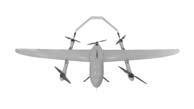
SPV6 Long-Range VTOL Drone: 100-Minute Flight Time and 1 kg Payload Capability

The SPV6 Long-Range VTOL Drone is designed for missions that require both flexible takeoff and efficient long-distance flight. Its vertical takeoff and landing capability allows operators to launch and recover the aircraft in confined areas without a runway, while its fixed-wing flight mode supports stable and energy-efficient coverage across wide regions. With a flight time of up to 100 minutes, the drone can remain airborne for extended inspection, mapping, and surveying tasks.

Featuring a payload capacity of 1 kg, the SPV6 can carry suitable cameras, sensors, or other mission equipment for professional data collection. It can support infrastructure inspections, land surveys, agricultural observation, environmental monitoring, and emergency-area assessment. The combination of long endurance, vertical operation, and horizontal cruising makes it practical for locations where conventional aircraft or runway-dependent systems are difficult to deploy.

As part of a wider range of long-range VTOL unmanned aerial vehicles, this type of drone can be selected according to operational distance, payload needs, and environmental conditions. Its flexible design helps reduce deployment limitations while allowing teams to cover large areas with fewer takeoff and landing points, making it a useful option for commercial and industrial aerial operations.

FAQS

How should a rescue drone mission be defined?

Identify who needs help, where they may be, and how quickly teams must respond. A missing hiker may need thermal imaging at dusk. Flooded streets may require a spotlight, loudspeaker, or small medical payload. Keep the plan practical.

Which environmental conditions must operators examine?

Measure wind, rain, temperature, visibility, and signal interference around likely launch sites. Salt spray can harm poorly protected equipment. Tall buildings may block satellite positioning, while narrow valleys can weaken communications. Conditions change.

How should battery endurance be calculated?

Count outbound flight, return distance, wind resistance, and a safe reserve. Never plan around advertised endurance. A strong headwind can consume the return reserve unexpectedly. That risk is easy to underestimate.

What camera and sensor combination is useful?

Thermal imaging helps locate people in darkness or beneath light cover. Daylight cameras need stable zoom and clear detail. Altitude sensing and obstacle detection help near smoke, trees, and damaged structures. Thermal alone can mislead.

How should communication systems be evaluated?

Test practical range, latency, and control stability behind trees, hills, and concrete. A dual-link or mesh arrangement may preserve control after one connection weakens. Encryption can protect transmitted mission data. Test locally.

Which navigation systems are important?

Combine satellite positioning with inertial and visual navigation. This supports flight near cliffs, buildings, and heavy smoke. Satellite signals can fail. Plan for degraded positioning.

How can teams prepare equipment before deployment?

Test the aircraft, sensors, batteries, and data link before reaching the emergency site. Use a short practice flight in similar terrain. Check wet gloves, poor lighting, wind, rain, glare, and darkness. Small tests reveal uncomfortable weaknesses.

What practical details should a launch plan include?

Confirm safe launch and landing space, obstacle clearance, night-operation needs, and local aviation requirements. Operators should know whether controls remain usable with wet gloves. A brochure cannot answer that.

How should teams judge whether a drone is suitable?

Match the equipment to its honest mission limits, not its most impressive demonstration. A showroom flight may succeed while a wet forest exposes weaknesses. Review failures openly. Perfect plans do not exist.

Conclusion

Choosing the right Rescue Drone begins with clearly defining the mission and operating environment. Consider whether it will support search operations, disaster assessment, medical supply delivery, or remote observation, then evaluate terrain, weather, flight duration, and required coverage. Compare suitable drone types by examining payload capacity, portability, stability, and essential rescue functions. Flight range, battery endurance, wind resistance, waterproofing, and reliable performance in difficult conditions are also critical factors.

Next, assess the quality of cameras and sensors, including low-light, thermal, mapping, and obstacle-detection capabilities. Secure communication, accurate navigation, return-to-home functions, geofencing, and emergency landing options can improve operational safety. Operators should also review local aviation rules, training requirements, and authorization procedures before deployment. Finally, calculate the complete cost of ownership, including equipment, batteries, software, maintenance, training, and replacement parts. A well-chosen Rescue Drone should provide dependable performance, manageable operating costs, and long-term value rather than relying only on the lowest purchase price.
Alyssa

Alyssa

Alyssa is a dedicated marketing professional at Space Innovation Co., Ltd., a pioneering company in the drone industry based in Shenzhen. With over a decade of experience in research and development, manufacturing, and sales of unmanned aerial vehicles (UAVs) and drone accessories, she possesses an......
Previous China Top 10 Reconnaissance Drone Manufacturers?